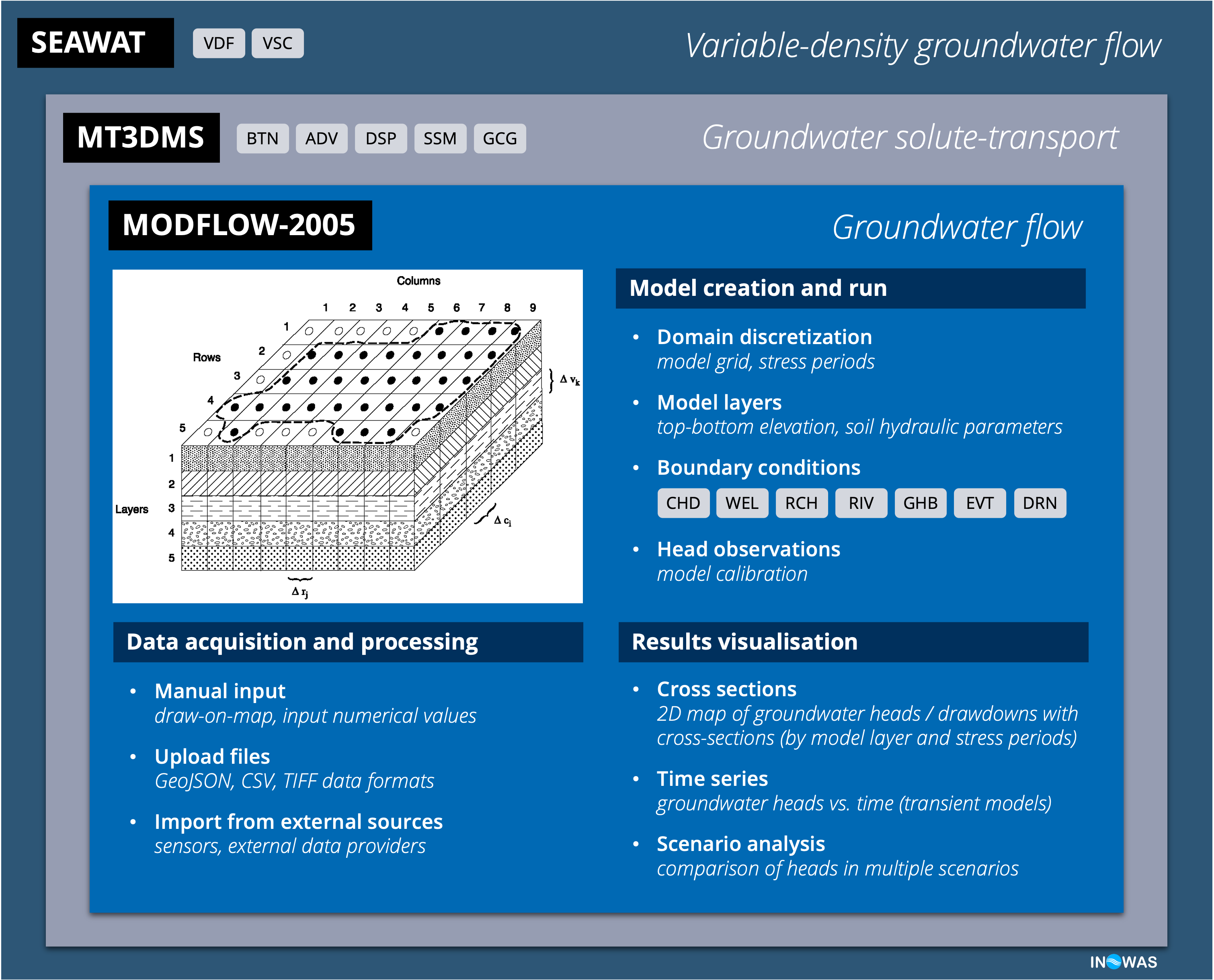
The INOWAS platform uses MODFLOW-2005, a three-dimensional finite-difference groundwater model developed by US Geological Survey that can be used to simulate steady and transient water flow through an aquifer system. Using FloPy (the Python package for creating, running, and post-processing MODFLOW-based models), we developed several features that are grouped in individual web-tools. Supported by a simple yet powerful graphic interface, the user can create groundwater flow models equipped with additional packages for solute transport (MT3DMS), variable-density flow and transport (SEAWAT), as well as scenarios analyser and semi-automatic groundwater flow modelling using (near) real-time sensor data.
Groundwater flow modelling with MODFLOW-2005
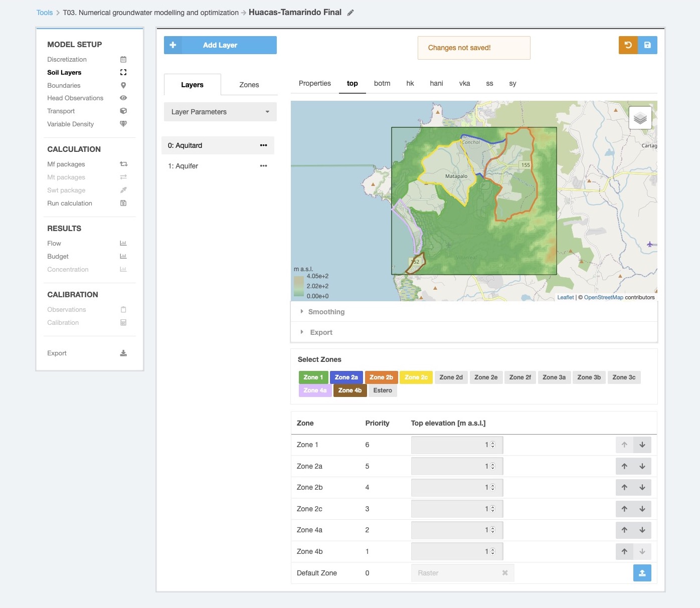
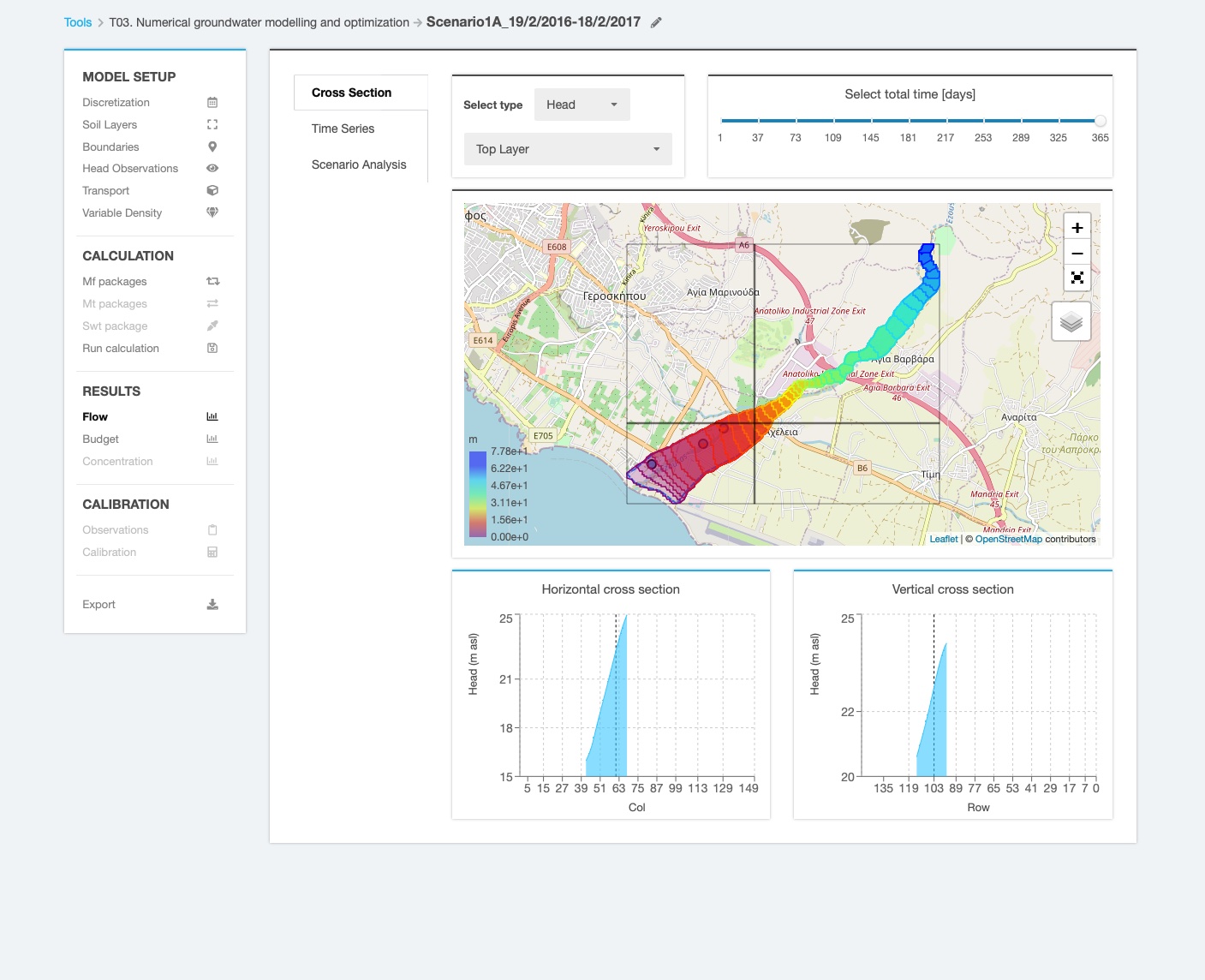
The platform allows users to create, write and read input and output MODFLOW-2005 files, as well as to calculate groundwater flow models. To create a groundwater flow model, the platform allows the spatial and temporal domain discretisation, delineation of model layers, definition of system boundary conditions, assigning hydraulic flow parameters, execution, calibration and validation of the model. The most relevant features of the basic version include: all input files can be created using the browser interface, additional data (polygons, time series, rasters) can be uploaded in GeoJSON, CSV and TIFF formats, sensor data defined in monitoring tool can be imported as boundary or observation data, most relevant flow boundaries are supported (CHD, FHB, WEL, RCH, RIV, GHB, EVT, DRN – more can be included upon request), access to model calculation logs, visualisation of calculation results (time-dependent groundwater heads and drawdown, time-series of groundwater heads in selected locations, cumulative budget), and manual calibration using head observations.
Groundwater solute transport modelling with MT3DMS
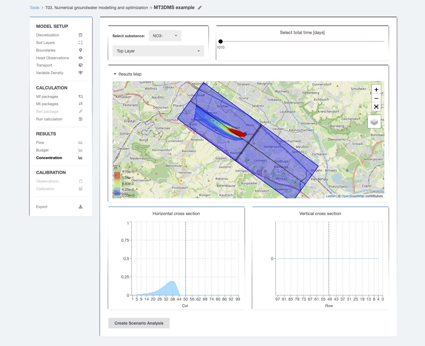
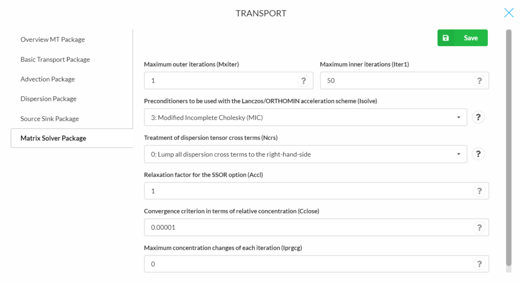
The simulation of solute transport can be integrated in the groundwater flow model using the MT3DMS package for MODFLOW. MT3DMS is a three-dimensional multi-species solute transport model developed also by USGS that can solve advection, dispersion, and chemical reactions of contaminants in saturated groundwater flow systems. The package can be used for example to analyse water quality, geochemical processes, recovery efficiency and residence time in MAR schemes. The following packages are supported right now by the INOWAS platform (more can be implemented in the future): basic transport package (BTN), advection package (ADV), dispersion package (DSP), source sink package (SSM), and the matrix solver package (GCG). Note that only one species can be modelled at the moment.
Variable-density groundwater flow and transport modelling with SEAWAT
Variable-density flow can be added to the numerical groundwater flow and transport simulation using SEAWAT, the USGS package for simulation of three-dimensional variable-density flow and transport. A requirement for using SEAWAT is that a groundwater flow model was created and the solute transport feature is active. This is necessary as SEAWAT uses some solute transport parameters for the simulation. In addition, the change of viscosity can be included into the simulations, which allows also the transport of heat to be simulated. The software uses two specific packages such as the variable-density flow package where specific parameters are compiled about the fluid density, and the viscosity package where viscosity-related data is needed. The results of the computation are expressed in form of concentration map in a similar way as the results of the solute transport equation. In the context of managed aquifer recharge (MAR), the tool can be used to assess the saltwater intrusion in coastal aquifers and the impact of aquifer management on the saltwater intrusion behaviour.
Additional features
In addition to the models presented above, the platform provides custom solutions aimed at enhancing the user experience and expanding the functionality of web-based software from the MODFLOW family. So far, two important features have been added: a scenarios manager that makes the interpretation of MODFLOW results much easier, and the option to run the MODFLOW models in semi-automatic mode by using data from groundwater sensors in (near) real-time.
Scenarios manager of MODFLOW models
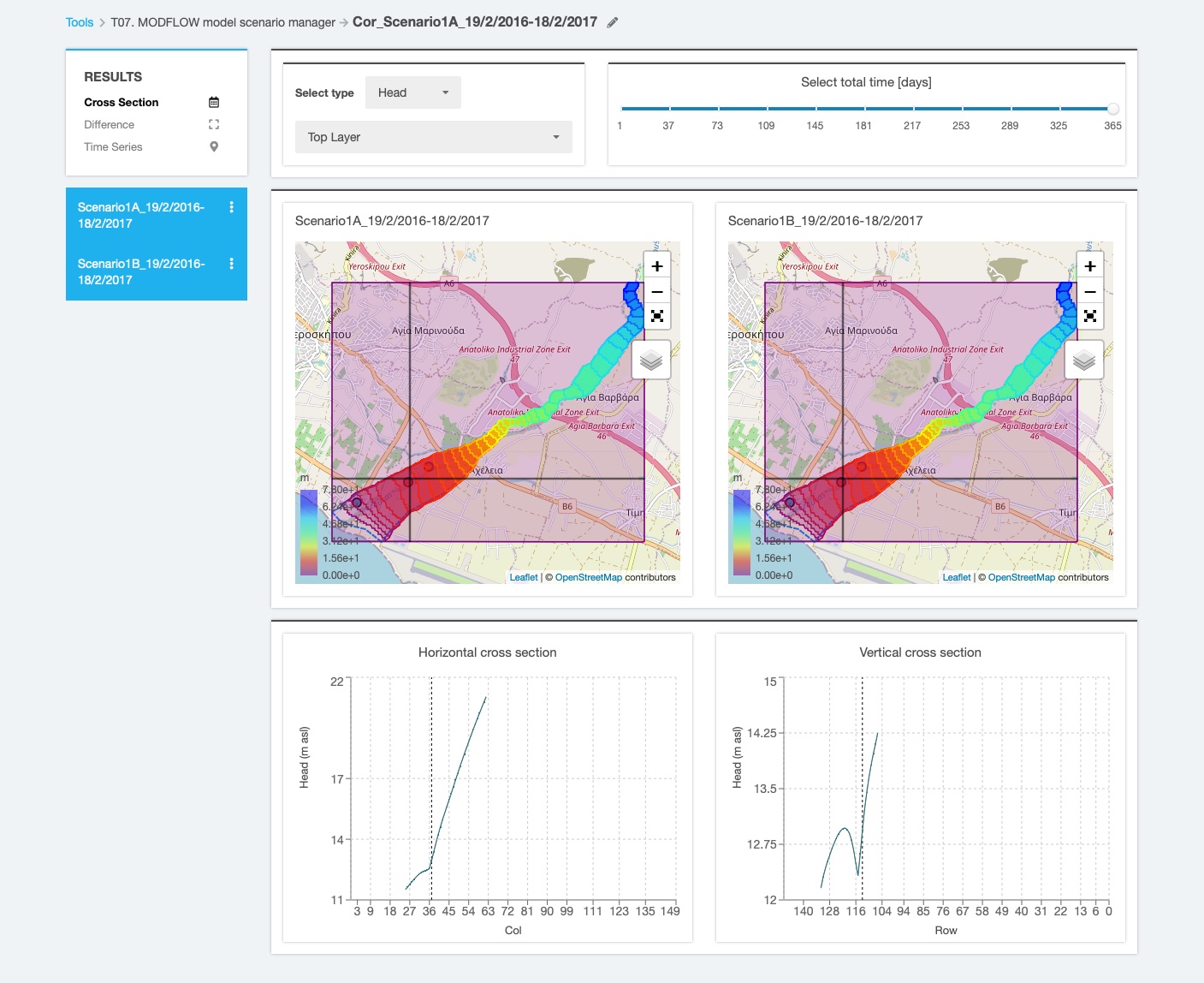
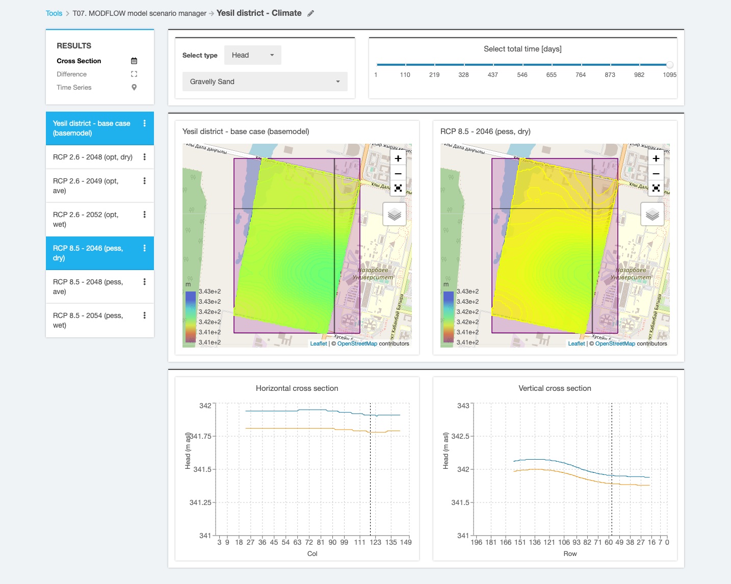
An important feature of the platform is the possibility to analyse and compare user-defined model scenarios. Scenario analysis can be used to evaluate various management solutions or to integrate climate, land use or urban change projections into the numerical model. Several results visualisation options are available including: cross section view (2D representation of groundwater heads with vertical and horizontal cross-sections through model area), scenarios difference view (2D representation of groundwater heads resulted as difference between the values of two scenarios), and, for transient models the time series view (time series of groundwater heads over simulation time). The number of scenarios analysed is not limited so multiple scenarios of the same base-model can be compared to each other. Moreover, the scenarios can be cloned, further edited and reloaded for comparison, providing thus a very versatile interpretation of the results.
Semi-automatic groundwater flow modelling using (near) real-time sensor data
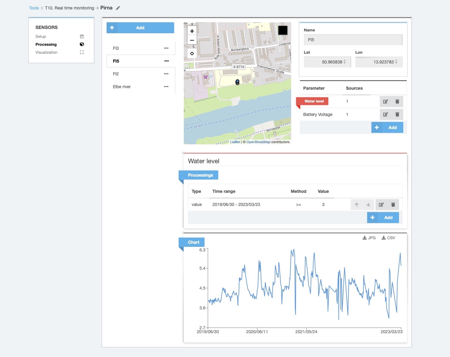
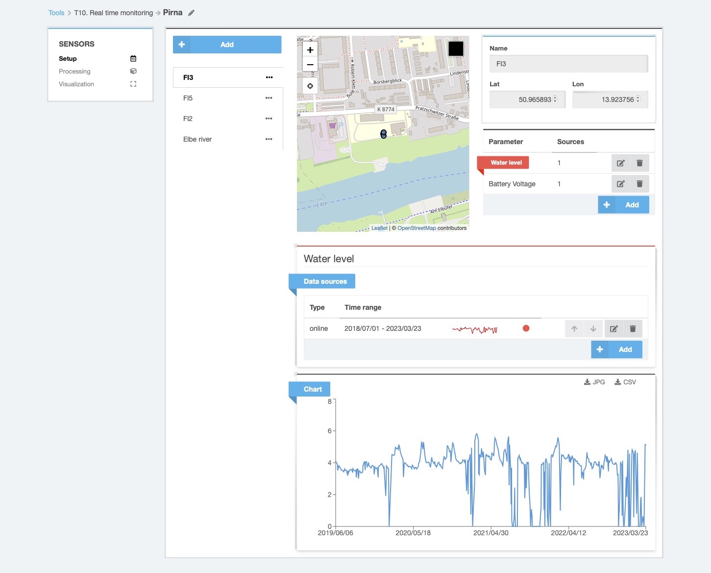
An additional feature of the platform allows the users to extend an existing groundwater flow model with new observation data imported in (near) real-time from external sources (sensors or public service providers). To facilitate this option, an monitoring tool allows the acquisition and pre-processing of time series data such as groundwater level measurements, recharge rates, river stages, etc. After applying a set of reclassification rules, the new datasets are automatically added as new stress periods to the model’s boundaries. Currently, the calculation process needs to be initiated manually but continuous efforts are invested to further improve the system.