Development of a demo groundwater flow model for an urban area under rapid development in Kazakhstan to evaluate the integration of nature-based solutions in the urban drainage and stormwater management strategies of the city.
Scope
To evaluate different groundwater management scenarios in a fast developing urban area and to assess the impact of different strategies for stormwater management and urban drainage.
Location
Pilot area within the Yesil district of Astana, Kazakhstan. See on map.
Conceptual model
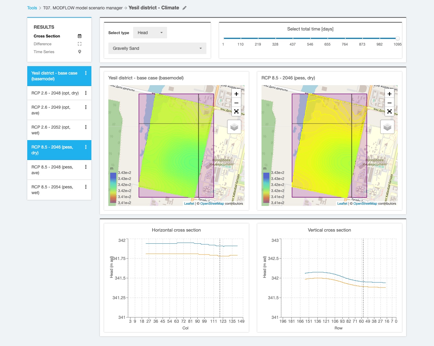
- Model area: about 306 ha, model grid of 200 rows x 150 columns and cell size of about 10 x 10 m
- Daily time steps and monthly stress periods for 3 years
- Three model layers: silty loam (0-1.5 m), sandy loam (1.5 – 3.5 m) and gravelly sand (3.5 – 10.0 m) obtained from boreholes log data
- Boundary conditions: recharge boundary divided into 30 individual parcels with different perviousness degree representing the newly-built areas with recharge rates estimated from rainfall and snowmelt, perimeter boundaries with values derived from nearby surface water bodies, evapotranspiration rates calculated for the entire model domain.
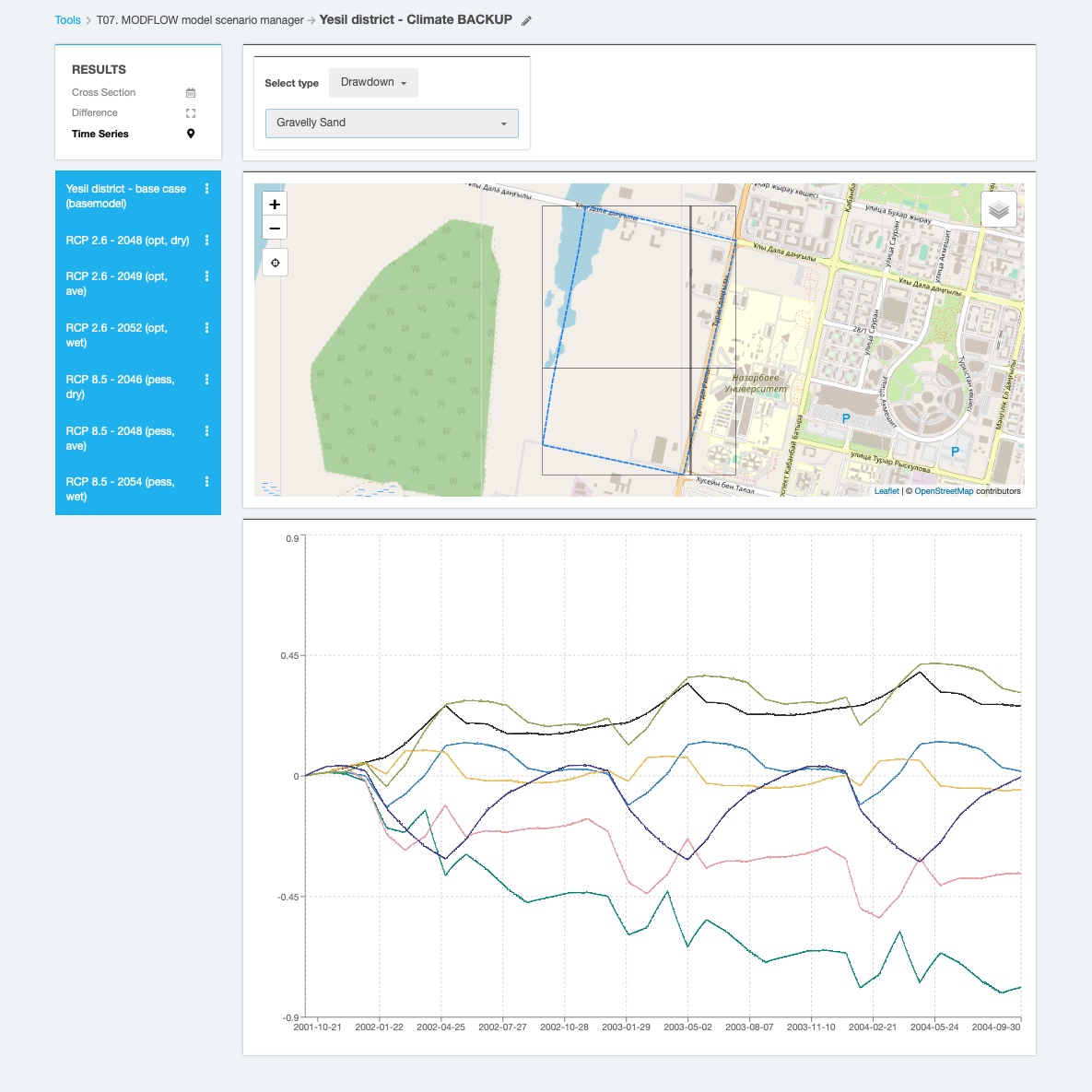
Simulation scenarios
- Evaluation of impact of climate change scenarios (RCP 2.6 and RCP 8.5)) calculated on dry, average and wet years
- Comparison of groundwater budgets for natural vs. build conditions
- Assess the influence of sustainable urban drainage solutions on available water budget and drafting water management strategies
Model results
Authors
Jana Sallwey
Research Group on Managed Aquifer Recharge INOWAS
Department of Hydrosciences
Technische Universität Dresden
Germany
Acknowledgement
The model was development within the framework of the CLIENT II project “Urban water management: German expertise for Kazakh cities (TERESA)” funded by the German Federal Ministry of Education nd Research (BMBF), grant no. 02WCL1552A.