Promote the development of managed aquifer recharge strategies using a demonstrative groundwater model for the shallow Boa Viagem aquifer in Recife, Brazil and simulation of different infiltration scenarios for mitigation of saltwater intrusion.
Scope
To provide a simplified yet flexible numerical groundwater flow model that can be used to discuss opportunities for implementation of managed aquifer recharge solutions in Recife Metropolitan Area in the Pernambuco state of Brazil.
Location
Recife Metropolitan Area in Pernambuco state of Brazil. See on map.
Conceptual model
- domain boundary following the spatial delineation of the shallow, unconfined Boa Viagem aquifer
- one model layer, about 40 m average thickness, hydraulic conductivity: 9.3 x 10⁻⁵ m/s (fine to medium sand and poorly sorted deposits of sand, silts and clay); model physical boundaries: Jiqui river (north), coastline (east), natural boundary where the aquifer thickness becomes very low (south-west)
- 93 wells randomly distributed along the coastline in the densely populated areas, flow rates from 5 to 100 m3/h, total abstraction rate: 3026 m3/h. One injection well along the coast with 300 m3/h for testing purposes
- specific yield from 0.03 to 0.1 (mean value 0.065), specific storage: 1.2 x 10⁻⁶ – 1.34 x 10⁻⁶ m-1
- simulation period one year, 52 stress periods of one week length
Simulation scenarios
- steady-state mode: base scenarios with hypothetical distribution of pumping wells along the coastline and one additional injection well with 300 m3/h injection rate in continuous mode
- transient mode: three pumping scenarios – a) continuous pumping, b) pumping only during dry season (August to March), c) pumping only during dry season + injection during wet season (April to July)
Model results
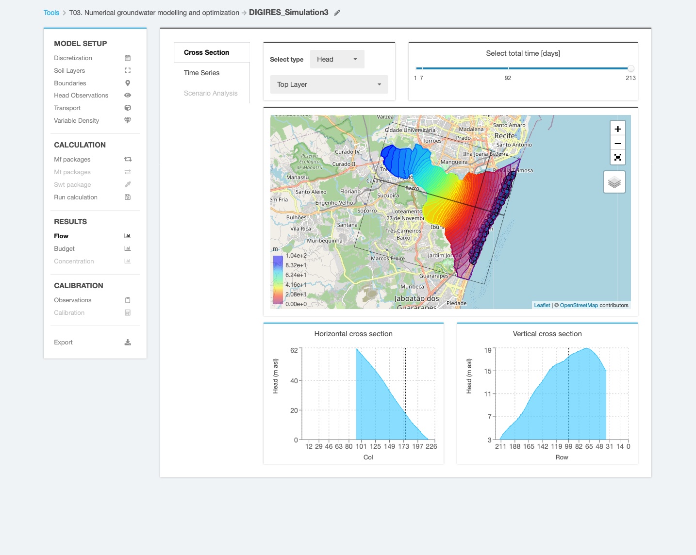
As result of groundwater pumping from the wells located very close to the coastline, the piezometric level of Boa Viagem aquifer can decrease down to -6 m below the average sea level, possibly inducing saltwater intrusion. For testing purposes, one injection well with 300 m3/h was added close to the coastline at three different locations (where the highest drawdown was noticed), which helped to increase the piezometric level around the well from -2 m to 14 m above sea level. The model was created using the GMS software and transferred to the INOWAS platform for shared use by Brazilian partners.
Authors
Pascal GODERNIAUX, Mathilde GUILLAUME, Antoine SCOHIER
Université de Mons, Belgium
Acknowledgement
The model was developed within the framework of the ERANET-LAC project “Digitally-enabled green infrastructure for sustainable water resources management in Latin America and the Caribbean (DIGIRES)” with financial support provided by the National Fund for Scientific Research (FNRS), Belgium.